


Real World Recreations #3
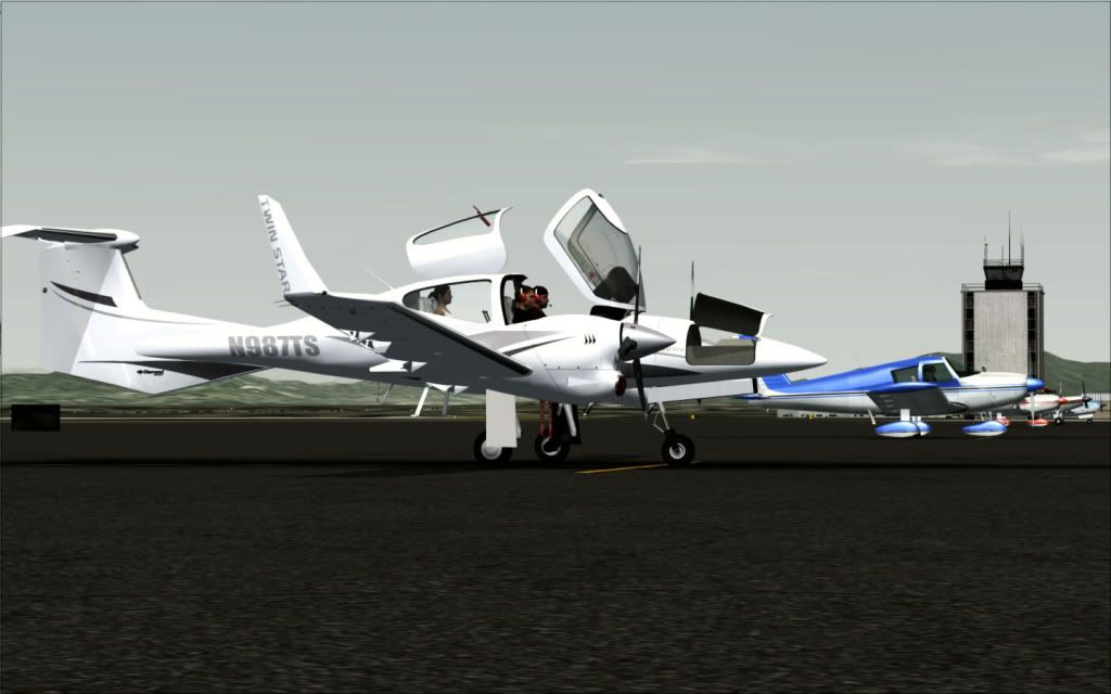
Diamond DA42 Twin Star N987TS
Long Beach, California to Camarillo, California in Tileproxy
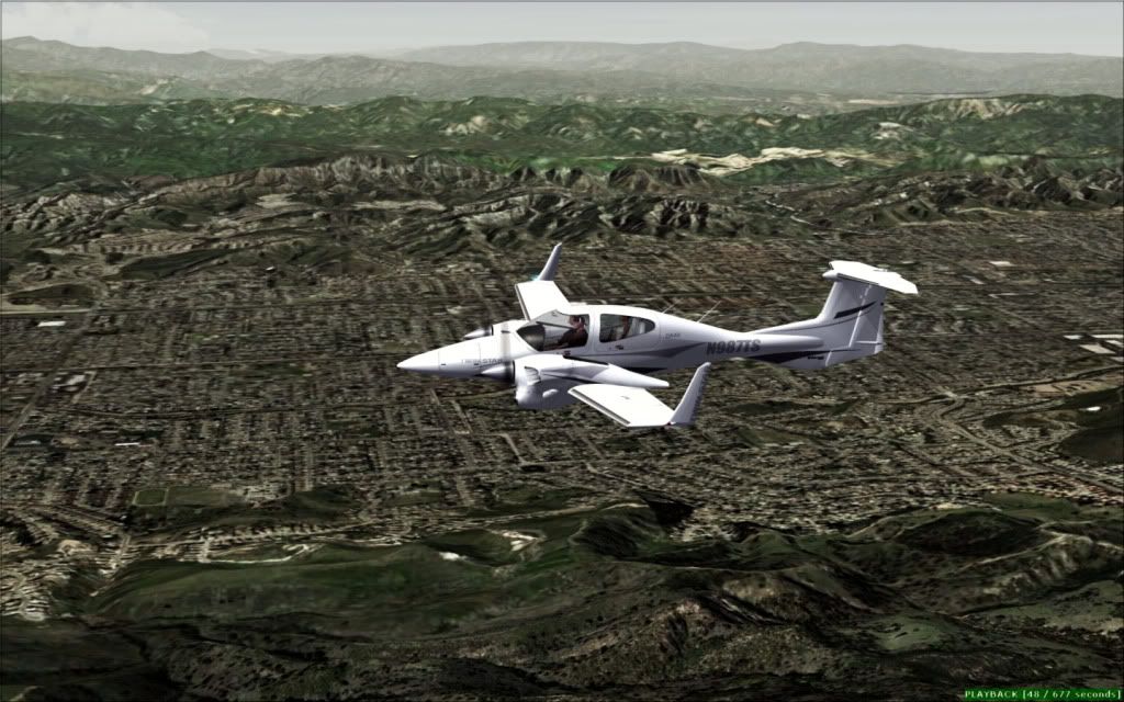
Well all, I'm back with another flight of the beautiful Diamond Twin Star N987TS, from Long Beach, California.
You all first of all know how much I love to give the technical detail of the trips first, so here's the rundown as usual:
Aircraft: IRIS's DA42 Twin Star from SIM MARKET
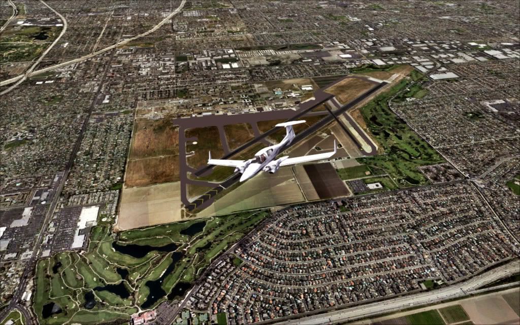
Departure: Daugherty Field, Long Beach, California: KLGB
Arrival: Camarillo
Weather: Real World Weather Courtesy of REX
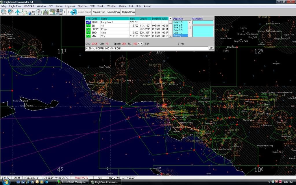
The Route in Flightsim Commander:
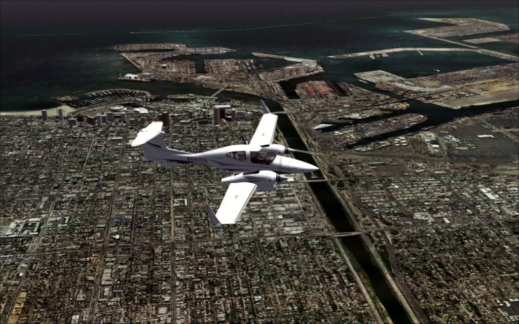
Did you know Long Beach is a city located in southern California, USA, on the Pacific coast. It is situated in Los Angeles County, about 20 miles (32 km) south of downtown Los Angeles. Long Beach borders Orange County on its southeast edge.
Long Beach is the 36th-largest city in the nation and the fifth-largest in California. As of January 1, 2009, its estimated population was 492,682. In addition, Long Beach is the 2nd largest city within the Los Angeles metropolitan area. The city completely surrounds the city of Signal Hill.
The Port of Long Beach is one of the world's largest shipping ports. The city also has a large oil industry; oil is found both underground and offshore. Manufacturers include aircraft, automobile parts, electronic and audiovisual equipment, and home furnishings. It is also home to headquarters for corporations such as Epson America, Molina Healthcare, and SCAN Health Plan. Long Beach has grown with the development of high-technology and aerospace industries in the area.
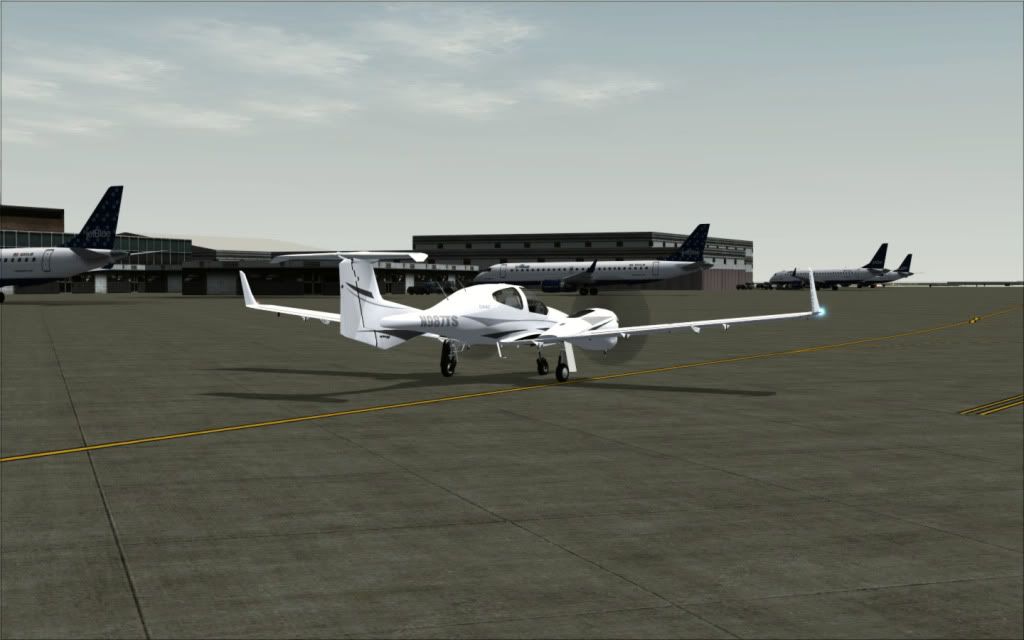
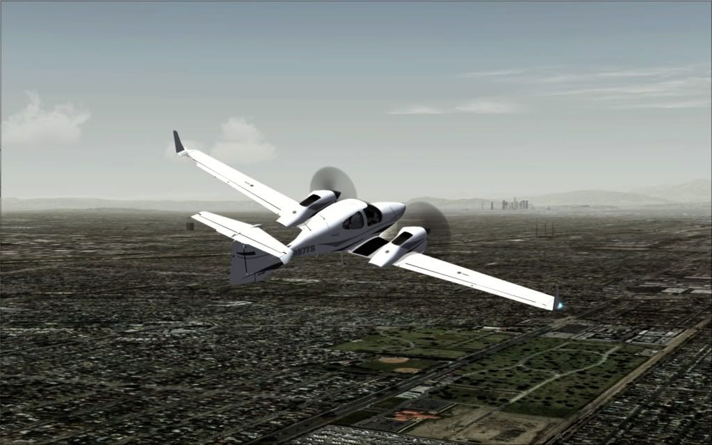
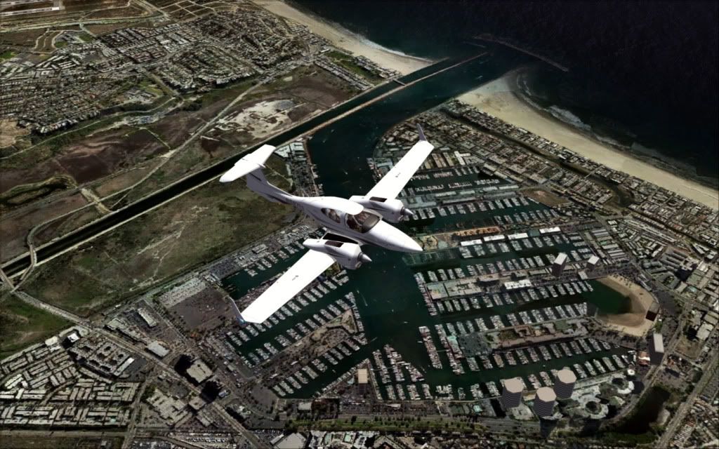
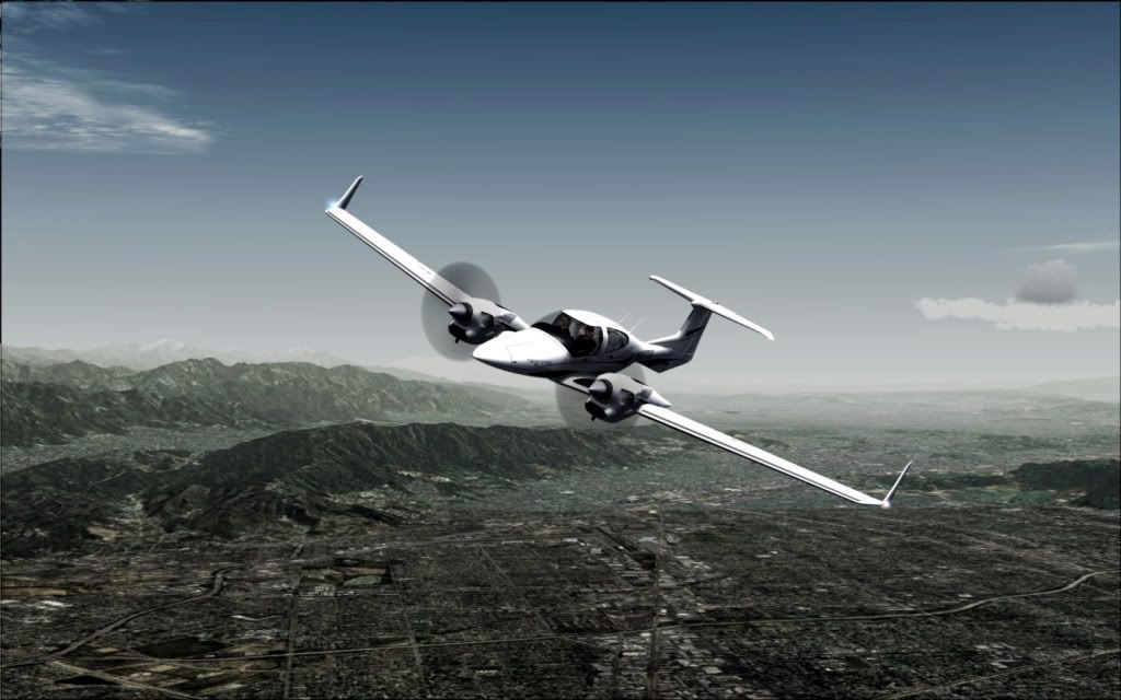
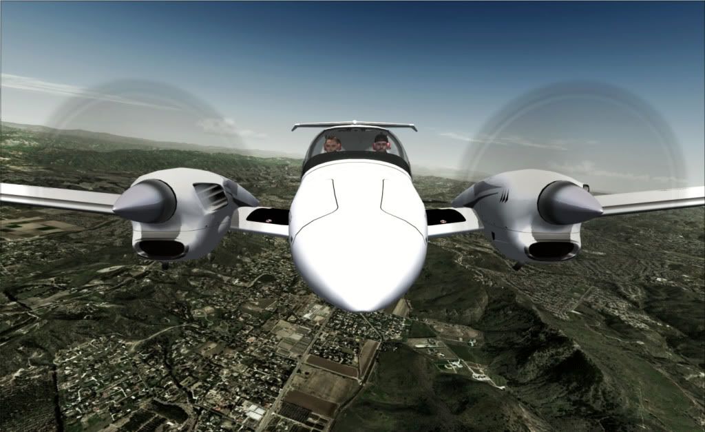
Taxiing out � the Diamond, like the Starship, is so uniquely shaped, it just makes everything else look just �There".
The top commercial businesses in Long Beach, based upon the number of employees, are: Boeing, Verizon, Gulfstream Aerospace, and The Bragg Companies (crane and heavy transport sales). Several local hospitals are major employers, including: Long Beach Memorial Medical Center, Veterans Affairs Medical Center, St. Mary Medical Center, and Pacific Hospital of Long Beach. Major government and educational employers include: Long Beach Unified School District, City of Long Beach, California State University, Long Beach, Long Beach City College, United State Postal Service, and Long Beach Transit.
Douglas Aircraft Company (later McDonnell Aircraft Corporation and now part of Boeing) had plants at the Long Beach Airport where they built aircraft for World War II, and later built DC-8s, DC-9s, DC-10s, and MD-11s.
Boeing built the Boeing 717 until 2006 and continues to build the C-17 Globemaster III strategic airlifter in Long Beach. Even after greatly reducing the number of local employees in recent years, Boeing is still the largest employer in the city.
Polar Air Cargo, an international cargo airline, was formerly based in Long Beach.
TABC, INC., a part of Toyota, makes a variety of car parts, including steering columns and catalytic converters, in Long Beach.
U.S. Epson, Inc. the U.S. affiliate of Japan-based Seiko Epson Corporation, is headquartered in Long Beach.
Pioneer Electronics, the U.S. affiliate of Japan-based Pioneer Corporation, is headquartered in Long Beach.
SCAN Health Plan, a non-profit "Medicare Advantage" HMO for seniors, is headquartered in Long Beach.
Molina Health Care, Inc., a Medicaid management healthcare program, is headquartered in Long Beach.
Jesse James' West Coast Choppers custom motorcycle shop is located in Long Beach, and much of the Monster Garage cable TV show is filmed in Long Beach.
Acres of Books, the largest and oldest family-owned second-hand bookstore in California. Closed down Oct. 18th., 2008
Long Beach Green Business Association, organization working to create economic growth through the promotion of green business and promoting a buy local program for Long Beach
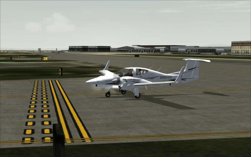
Holding short with a Maule in the distance taxiing to the active.
As of 2005, the Port of Long Beach was the second busiest seaport in the United States . The port serves shipping between the United States and the Pacific Rim. The combined operations of the Port of Long Beach and the Port of Los Angeles are the busiest in the USA.
Rail shipping is provided by Union Pacific Railroad and BNSF Railway, which carry about half of the trans-shipments from the port. Long Beach has contributed to the Alameda Corridor project to increase the capacity of the rail lines, roads, and highways connecting the port to the Los Angeles rail hub. The project, completed in 2002, created a trench 20 miles (32 km) long and 33 feet (10 m) deep in order to eliminate 200 grade crossings and cost about US$2.4 billion.
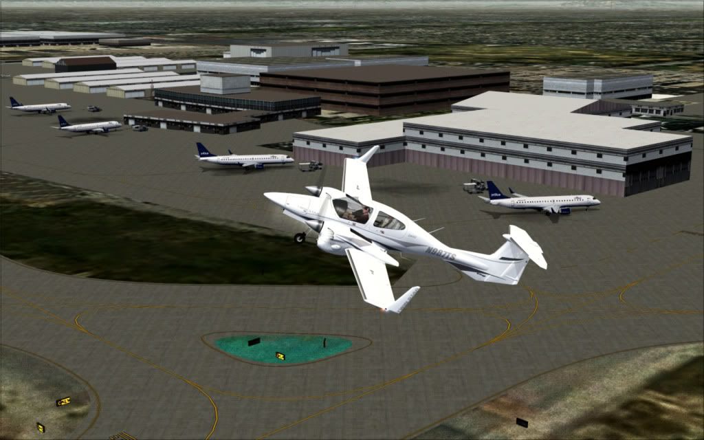
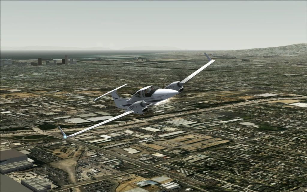
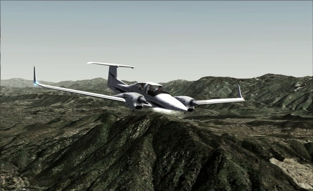
Take Off! I know, a relatively steep climb.
Long Beach is the southern terminus for the Los Angeles Metro Blue Line light rail corridor. Blue Line trains run from Long Beach City Hall to Downtown Los Angeles. The Metro Rail Blue Line Maintenance Shops are also located in Long Beach just south of the Del Amo Blue Line station.
There is an Amtrak Thruway bus shuttle starting in San Pedro, with stops at the Queen Mary and downtown Long Beach, that then goes to Union Station in downtown Los Angeles, and ends in Bakersfield. The Blue Line MetroRail connects downtown Long Beach to the Staples Center and downtown Los Angeles where it connects with Hollywood and Pasadena.
Greyhound Lines operates the Long Beach Station in downtown Long Beach.
Public transportation in Long Beach is provided by Long Beach Transit. Besides the normal bus service, which charges a fare, Long Beach has free routes, the Passport routes, which use mini-buses to shuttle passengers within the downtown area. The Passport "C" route between the downtown, The Aquarium, The Pine Ave. Circle, Shorline Village, and the Queen Mary, and Passport "A" and "D" buses go East-West along Ocean Boulevard, linking the Catalina Landing in the west with Alamitos Bay or Los Altos via Belmont Shore in the east. A $1.25 fare is required when traveling east of Alamitos Avenue. Another free route, Passport "B" in the East Village, visits museums and other points of interest.Long Beach Transit Web Site
Long Beach Transit also operates the 49-passenger AquaBus water taxi, which stops at the Aquarium of the Pacific, the Queen Mary, and four other locations; and the 75-passenger AquaLink water taxi, which travels between the Aquarium, the Queen Mary, and Alamitos Bay Landing next to the Long Beach Marina.
There is also limited bus service to Orange County through Orange County Transportation Authority buses. Route 1, from Long Beach to San Clemente is the longest bus route in the OCTA system. Traveling along Pacific Coast Highway for most of the route, it takes 2-2.5 hrs to complete.
Torrance Transit buses go from downtown Long Beach to the South Bay. The Los Angeles Department of Transportation (LADOT) has bus service from downtown to San Pedro, and the Los Angeles County Metropolitan Transportation Authority (LACMTA) has two regional bus lines that serve downtown Long Beach.
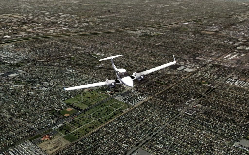
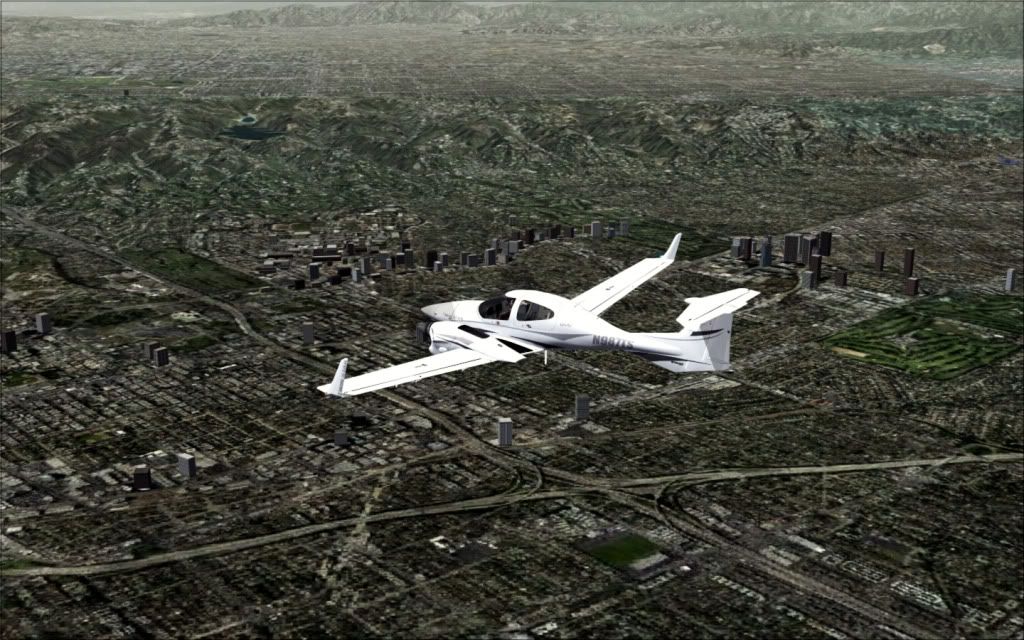
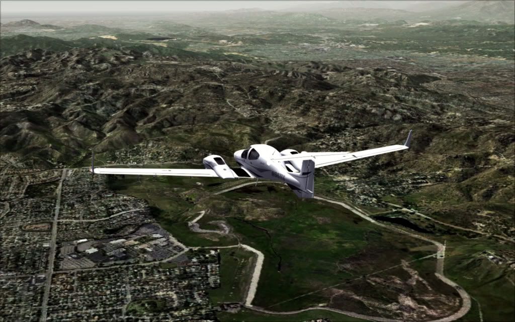
Doing the circuit around the airport to get up to cruise altitude. The City of Los Angeles in the distant smog and haze.
Long Beach Airport serves the Long Beach, South Bay and northern Orange County areas, but is relatively small, considering the area's population. It is the West Coast hub for JetBlue Airways. It is also the site of a major Boeing (formerly Douglas, then McDonnell Douglas) aircraft production facility, which is the city's largest employer.
Leaving behind Long Beach
Several freeways run through Long Beach, connecting it with the greater Los Angeles and Orange County areas. The San Diego Freeway (I-405) bisects the northern and southern portions of the city and takes commuters northwest or southeast to the Golden State/Santa Ana Freeways (I-5). The San Diego Freeway also provides regional access to Long Beach Airport, which is located on the north side of the freeway near Signal Hill. The Long Beach Freeway (I-710) runs north-south on the city's western border, with its southern terminus adjacent to the Port of Long Beach on Terminal Island at the intersection of the Terminal Island Freeway (SR 103) and State Route 47. The Long Beach Freeway is the major spur route serving Long Beach from Downtown Los Angeles, with its northern terminus near Downtown Los Angeles in Alhambra. Along with the Harbor Freeway (I-110) to the west, the Long Beach Freeway is one of the major routes for trucks transporting goods from the Ports of Long Beach and Los Angeles to railyards and distribution centers in Downtown Los Angeles and the Inland Empire. The southern end of the Long Beach Freeway joins Long Beach with Terminal Island via the Gerald Desmond Bridge.
Southeast Long Beach is served by the San Gabriel River Freeway (I-605), which joins the San Diego Freeway at the Long Beach/Los Alamitos border. The Artesia Freeway (SR 91) runs east-west near the northern border of Long Beach. The western portion of the Garden Grove Freeway (SR 22) provides a spur off of the San Diego and 605 Freeways to 7th Street in southeast Long Beach for access to the VA Hospital, California State University, Long Beach, and Alamitos Bay.
Pacific Coast Highway (SR 1) takes an east to southwest route through the southern portion of Long Beach. Its intersection with Lakewood Bouelvard (SR 19) and Los Coyotes Diagonal is the Los Alamitos Traffic Circle.
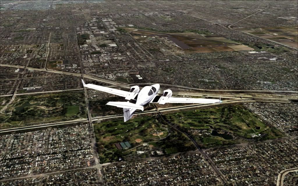
Over one of the many parks in Long Beach
The city is effectively on a "grid" system, in which Ocean Boulevard serves as the dividing line between north and south, and Pine Avenue dividing the city on the east and west. Almost all of the city is north of Ocean Boulevard, thus only addresses which are on the south side of the city need to be identified as being "south", while addresses in the north section of the city are never identified as "north". While more than 2/3 of the city is east of Pine Avenue, addresses on the west side are given a geographical designation, addresses on the east side are designated as "east". Also, with limited exceptions, streets running north-south are called "Avenue" and streets running east-west are called "Street". The most common exception is that short streets or avenues are typically called "Court", "Place", or "Way". Additionally, wide "avenues" will typically be named "boulevard", and the Traffic Circle has one exit for "Los Coyotes Diagonal", a road which runs from southwest to northeast as a diagonal road.
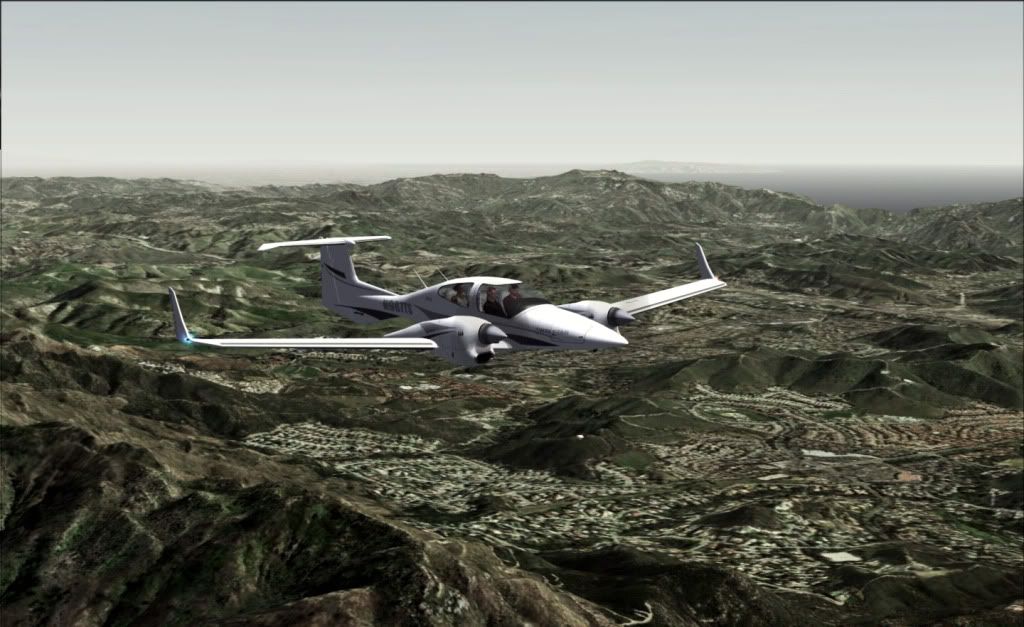
Turning to intercept our flight path. Never realized there were so many Golf Courses in the area.
Long Beach has some bike paths along city streets, plus the Shoreline Pedestrian Bikepath along the ocean from Shoreline Village to Belmont Shore. The southern terminus of the L.A. River bicycle path is located in southwest Long Beach between Downtown and the Port. The southern terminus of the San Gabriel River bicycle path is located just east of Long Beach in Seal Beach, and the trail runs north through the El Dorado Park neighborhood in east Long Beach and adjacent to El Dorado Regional Park.
Another Golf Course near the airport, this is Lakewood Golf Course, Carson Street running along the edge of it.
Balboa Amusement Producing Company, also known as Balboa Studios, was located at Sixth Street and Alamitos Avenue; they used 11 acres (45,000 m2) on Signal Hill for outdoor locations. Silent film stars who lived in Long Beach included Fatty Arbuckle and Theda Bara. The 1917 film Cleopatra, starring Theda Bara, was filmed at the Dominguez Slough just west of Long Beach, and Moses parted the Red Sea for Cecil B. DeMille's 1923 version of The Ten Commandments on the flat seashore of Seal Beach, southeast of Long Beach.
Because of its proximity to LA-area studios and its variety of locations, today Long Beach is regularly used for movies, television shows, and advertisements. The city has filled in for locations across the nation and around the globe. One advantage for Long Beach is that the film industry uses a zone that extends 30 miles (48 km) from Beverly Blvd. and La Cienega Blvd. in the West Hollywood area. It is cheaper to film within that zone, so Long Beach and other South Bay cities often stand in for areas of Orange County (such as for The O.C. TV show) because almost all of Orange County is outside of the zone.
One of the most famous Long Beach movie locations is the home of Ferris Bueller in Ferris Bueller's Day Off. Though the film was set in the North Shore suburbs of Chicago the actual house is located at 4160 Country Club Dr.
Long Beach's high schools are especially popular with the film industry. Long Beach Polytechnic High School has played host to numerous films, providing the outdoor high school grounds of Coach Carter and the indoor high school rooms and hallways of Robert A. Millikan High School American Pie, among others. Juan Rodriguez Cabrillo High School has been a very popular place to film movies as well, with 2-4 movies filmed per year, and is currently being used to film 20th Century Fox's musical comedy-drama, Glee. Recently, a film was shot in Jordan High School. St. Anthony High School's gymnasium has also been featured in many movies and television shows, including Coach Carter and Joan of Arcadia. Long Beach Woodrow Wilson High School has been used to film Alvin and the Chipmunks 2 The Squeakquel and many commericals featuring Nike and Addidas with LA Sparks Basketball star, Candace Parker. Long Beach Woodrow Wilson was also the focus of the movie "Freedom Writers".
Seal Beach with East Ocean Boulevard and RT1 Running through it.
Seal Beach is located in the westernmost corner of Orange County. To the northwest, just across the border with Los Angeles County, lies the city of Long Beach and the adjacent San Pedro Bay. To the southeast are Huntington Harbour, a neighborhood of Huntington Beach, and the unincorporated community of Sunset Beach. To the east lie the city of Westminster and the neighborhood of West Garden Grove, part of the city of Garden Grove. To the north lie the unincorporated community of Rossmoor and the city of Los Alamitos.
Early on, the area that is now Seal Beach was known as "Anaheim Landing", as the boat landing and seaside recreation area named after the nearby town of Anaheim.
By the 20th century, it was known as Bay City, but there was already a Bay City located in Northern California. When the time came to incorporate on 25 October 1915, the town was named Seal Beach. The town became a popular recreation destination in the area, and featured a beach-side amusement park long before Disneyland was founded inland.
The United States Navy's Naval Weapons Station Seal Beach was originally constructed during World War II for loading, unloading, and storing of ammunition for the Pacific Fleet, and especially those US Navy warships home-ported in Long Beach and San Diego, California. With closure of the Concord Naval Weapons Station in Northern California, it has become the primary source of munitions for a majority of the U.S. Pacific Fleet
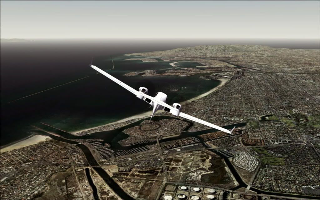
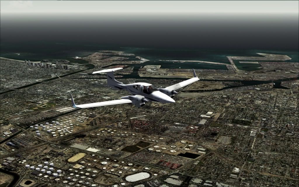
Climbing past the Queen Mary and the city of Long Beach, along with the aquarium in the distance.
Did you know that besides the Queen Mary, The nonprofit Aquarium of the Pacific is located on a 5-acre (20,000 m2) site on Rainbow Harbor in Long Beach, Calif.�across the water from the Long Beach Convention Center, Shoreline Village, and the Queen Mary Hotel and Attraction. The Aquarium features a collection of over 12,500 animals representing over 550 different species. The facility focuses on the Pacific Ocean in three major permanent galleries, sunny Southern California and Baja, the frigid waters of the Northern Pacific and the colorful reefs of the Tropical Pacific. Favorite exhibits at the Aquarium also include the Aquarium's interactive Shark Lagoon (guests can pet sharks and sting rays) and Lorikeet Forest (guests can feed nectar to colorful lorikeet birds). Exhibits at the Aquarium introduce the inhabitants and seascapes of the Pacific, while also focusing on specific conservation messages associated with each region. Exhibits range in size and capacity from about 5,000 to 350,000 gallons. The Aquarium of the Pacific has been visited by more than 13 million people since its opening. The Aquarium was rated #2 Los Angeles area Family Destination in the most recent Zagat U.S. Family Travel Guide, second only to Disneyland. The Aquarium of the Pacific is also the only major nonprofit aquarium in the nation to have attendance increases for the past six years in a row. Morey & Associates' research ranked the Aquarium of the Pacific as number one in visitor diversity among all of the nation's leading aquariums.
The Long Beach Department of Parks, Recreation and Marine received a Gold Medal award from the National Parks and Recreation Society in 2002, 2003, and 2004, recognizing the Department's "outstanding management practices and programs." The Department manages 92 parks covering over 3,100 acres (13 km�) throughout the city, including the 815 acre (3.3 km�) El Dorado Regional Park, which features fishing lakes, an archery range, youth campground, bike trails, and picnic areas. The Department also operates four public swimming pools, and four launch ramps for boaters to access the Pacific Ocean.
The 102.5-acre (0.4 km2) El Dorado Nature Center is part of the larger El Dorado Regional Park. The center features lakes, a stream, and trails, with meadows and forested areas.
The Municipal Fly Casting Pool at Recreation Park in East Long Beach is a 260-by-135-foot clear water, fishless pond built and operated since 1925 by the Long Beach Casting Club as only one of two Southern California city operated casting ponds (the other being in Pasadena). Described recently as a serene pond "surrounded by a seemingly endless stretch of green grass against a backdrop of mountains and palm trees," several movie stars from the 1940s were taught to fly cast at the pond, including Robert Taylor, Clark Gable, Jimmy Durante, and Barbara Stanwyck. In 1932, the fly fishing clubhouse adjacent to the fly fishing pond was used for the Summer Olympic Games and housed military personnel during World War II
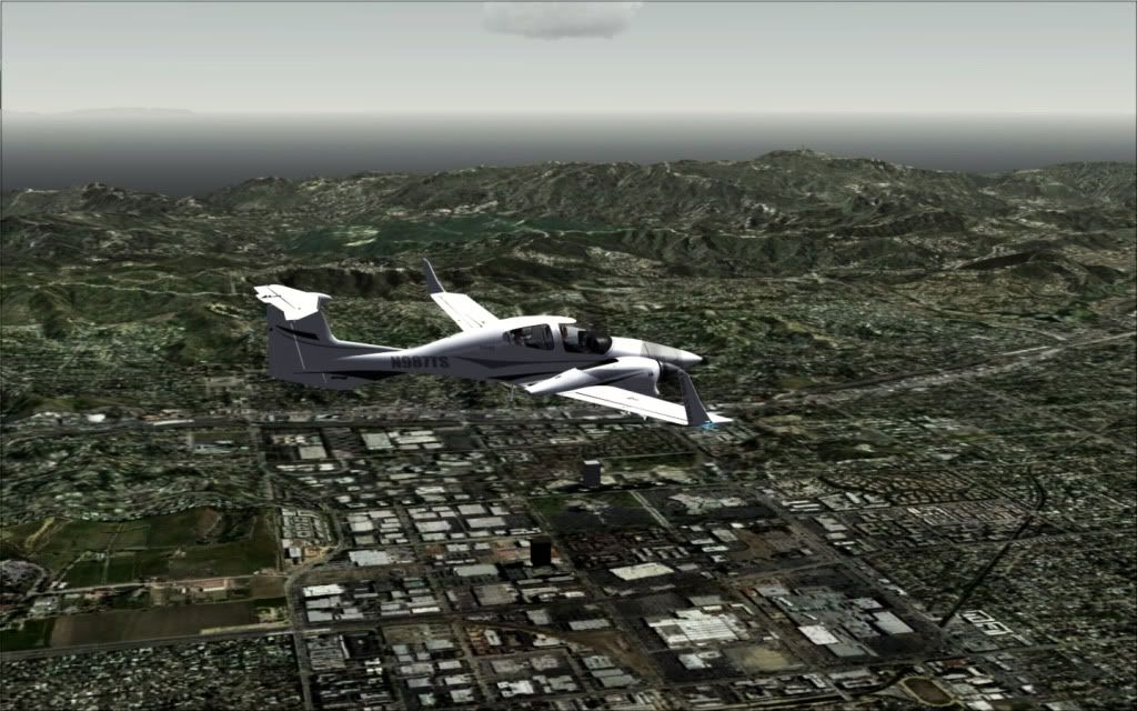
Now at cruise Altitude, we turn to intercept the flight path and crossing back over Long Beach Airport.
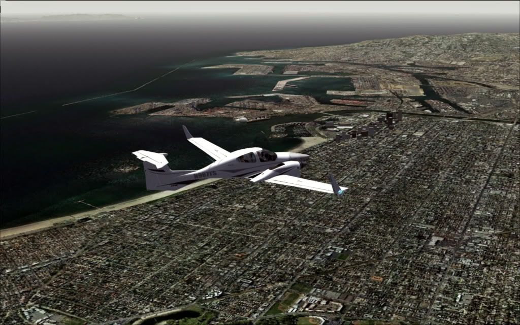
A closer shot of Long Beach and the Queen Mary, sitting Majestically at her pier.
The Long Beach Greenbelt is a section of the old Pacific Electric right-of-way, restored by community activists as native habitat. It currently supports approximately 40 species of California native plants as well as a plethora of urban wildlife. Its pleasant, relaxing atmosphere provides for community open space while educating citizens about what the land was like prior to industrialization and urbanization.
Rancho Los Alamitos is a 7.5-acre (30,000 m2) historical site owned by the City of Long Beach and is near the Long Beach campus of the California State University system. The site includes five agricultural buildings, including a working blacksmith's shop, 4 acres (16,000 m2) of gardens, and an adobe ranch house dating from around 1800. The Rancho is within a gated community, so you must pass through security gates to get to it.
Rancho Los Cerritos is a 4.7-acre (19,000 m2) historical site owned by Long Beach in the Bixby Knolls area near the Virginia Country Club. The adobe buildings date from the 1880s. The site also includes a California history research library.
Long Beach is home to the nation's skinniest house.
The Earl Burns Miller Japanese Garden is located on the campus of California State University, Long Beach.
Leaving Long Beach
Long Beach offers singing gondolier trips through the romantic canals of Naples. Along with gondola rides on Lake Merritt, on the Napa River, in Huntington Beach, in Newport Beach, in Redondo Beach, and at The Venetian (Las Vegas), Long Beach is only one of seven places in the Western United States where tourists may ride in a gondola.
The front beach area of the city was once home to a now-defunct amusement park. Its first rollercoaster opened for business in June 1907. It was named the Figure 8 after the shape of the tracks, and was built on pilings that reached out over the water. In 1914 the Pike Amusement Zone undertook several upgrades and a new roller coaster named the Jack Rabbit Racer was opened in May 1915 becoming the second largest racing coaster in the country. It was part of the Silver Spray Pier which included several new rides and concessions. In the mid twenties, several expansions were made to the area and the Jack Rabbit Racer was remodeled raising the ride's dips to a greater height and steepness but it was soon removed to make way for the Cyclone Racer roller coaster which opened May 1930. The new coaster was also built on pilings over the ocean, but as the breakwater was built and the harbor expanded, the sandy beach extended. Eventually the entire pier stood over the beach. When demolished in September 1968, the Cyclone Racer was the only two track roller coaster in the United States.
Although California's surfing scene is said to have gotten its start in Long Beach when in 1911 two surfers returned from Hawaii and the city hosted the first National Surfing and Paddleboard Championships in 1938, surfing is now uncommon in Long Beach due to a 2.2-mile (3.5 km) long breakwater built in 1949 to protect the U.S. Pacific Fleet. The breakwater reduces "mighty waves to mere lake-like lapping along the city's beaches." Some Long Beach residents also cite the breakwater as a reason for the dirtiness of the water in Long Beach, as the water is not able to circulate. The fleet left in the 1990s, and now some residents are calling for it to be lowered or eliminated and the city has commissioned a $100,000 study for this purpose.
The Long Beach Dog Beach Zone is the only legal off-leash area on the beach for dogs in all of Los Angeles County. This 3-acre (12,000 m2) area is situated in Belmont Shore between Roycroft and Argonne avenues.
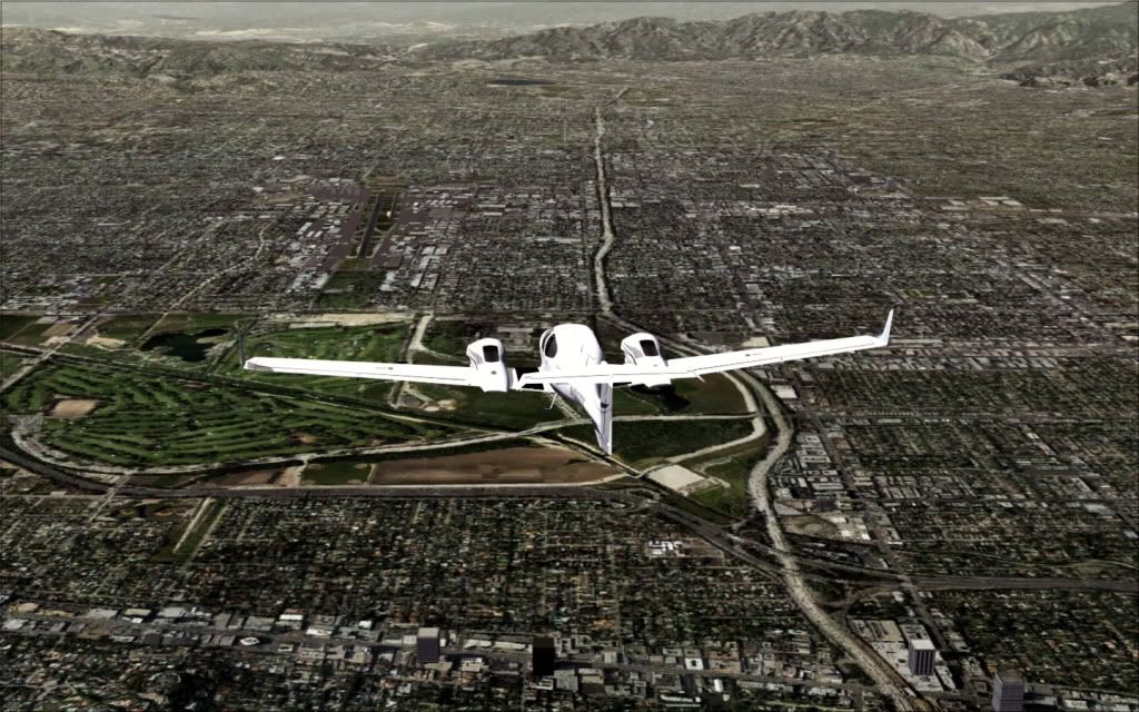
Traveling along 105 near Hollywood Park
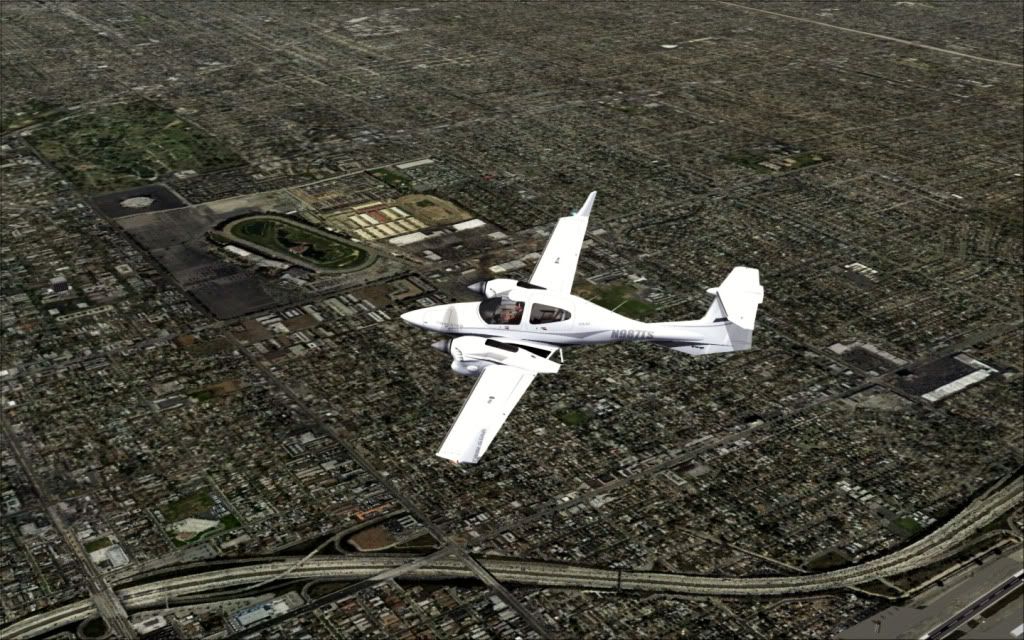
Hollywood Park is a thoroughbred race course and poker card room in Inglewood, California, about three miles (5 km) from Los Angeles International Airport and adjacent to the Forum.
The track was opened in 1938 by the Hollywood Turf Club[1]. The racetrack was designed by noted racetrack architect Arthur Froehlich. Its chairman was Jack Warner of Warner Brothers, and its 600 shareholders included many other Hollywood luminaries. Al Jolson and Raoul Walsh were members of the founding Board of Directors and Mervyn LeRoy was a director from 1941 until his death in 1987.
Hollywood Park closed from 1942 to 1944 due to World War II, being used as a storage facility. In 1949, the grandstand and clubhouse were destroyed by a fire; the rebuilt facility reopened in 1950. In 1984, the race track was extended from 1-mile (1.6 km) around to 1 1/8 miles around prior to the first Breeders Cup race. In 1986, the turf course was similarly expanded from just over 7/8 of a mile around to just over 1-mile (1.6 km) around. A card club casino was added to the complex in 1994. Churchill Downs, Inc. bought the facility for $140 million in 1999. The previous owners of the track renamed their company Pinnacle Entertainment to concentrate on its gambling interests.
In July 2005, Churchill Downs sold the track to the Bay Meadows Land Company for $260 million in cash. Under the terms of the deal, the company, which operates Bay Meadows in San Mateo, was to continue thoroughbred racing at Hollywood Park for at least three years. According to Bay Meadows officials, the continuation of Hollywood Park as a racing venue after that depends on California allowing more gambling, like slot machines, to the track. (The Orange County Register, July 7, 2005)
Some of the Hollywood Park land has been sold to real estate developers to build a new housing community called the Inglewood Renaissance. Development began in 2005.
A bartender at the track said on May 1, 2010 that the track would continue to operate for at least another five years.
New grass was planted on the turf course after Hollywood Park's spring-summer meet in 2005. Due to safety concerns, however, turf racing was not conducted for that year's autumn meet. As a result, several major stakes races that comprised Hollywood's Autumn Turf Festival were cancelled that year.
After the conclusion of Hollywood's spring-summer meet in 2006, it was announced that a second chute would be built inside the turf course to accommodate sprint races at six furlongs. This follows a similar move by Monmouth Park to build a turf chute for sprint races.
These races are the graded stakes races run at Hollywood Park.(All turf stakes listed below were put on a hiatus during the 2005 Autumn Meet)
I can just hear the conversation now:
�He's a Mudder�."
�Really? He's a mudder?"
�His mother was a mudder�"
�His mother was a mudder?????"
I remember those old sitcom and movie conversations�..even Seinfeld bought that up in an episode once with Kramer�
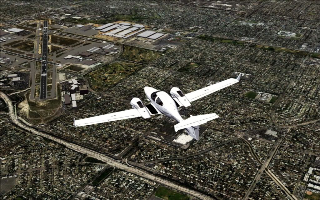
Approaching LAX
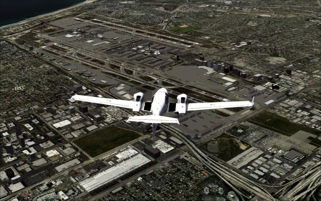
Our waypoint, LAX, Los Angeles International Airport (IATA: LAX, ICAO: KLAX, FAA LID: LAX) is the primary airport serving Los Angeles, California, the second-most populated metropolitan area of the United States. It is often referred to by its IATA airport code LAX, with the letters usually pronounced individually (IPA: /ɛl.eɪ.ɛks/). LAX is located in southwestern Los Angeles in the neighborhood of Westchester, 16 mi (26 km) from the downtown core.
With 59,542,151 passengers in 2009, LAX is the seventh busiest airport in the world and is served by direct flights to North America, Latin America, Europe, Asia, Oceania, and the Middle East. The airport is a major hub for United Airlines and Alaska Airlines and a focus city for American Airlines, Southwest Airlines, Allegiant Air, Air New Zealand and Virgin America. It also serves as an international gateway for Delta Air Lines.
The airport also functions as joint civil-military facility, providing a base for the United States Coast Guard and its Coast Guard Air Station Los Angeles facility, operating 4 HH-65 Dolphin helicopters.
LAX is the busiest airport in California in terms of flight operations, passenger traffic and air cargo activity, followed by San Francisco International Airport (SFO). LAX is also the only U.S. airport to serve 3 or more international destinations with ridership of 1 million passengers or more per year (Tokyo-Narita, London-Heathrow, Taipei).
Although LAX is the busiest airport in the Greater Los Angeles Area, the region relies on a multiple airport system because of its vast size. Many of the area's most well-known attractions are closer to alternative airports than to LAX; for example, Hollywood and Griffith Park are closer to Bob Hope Airport in Burbank, while Disneyland, the Honda Center, Angel Stadium of Anaheim, and other Orange County attractions are closer to John Wayne Airport in Orange County. Long Beach Airport is closer to some of the coastal attractions known to Southern California like Palos Verdes and Huntington Beach, and LA/Ontario International Airport is closer to the major cities of the Inland Empire, Riverside and San Bernardino.
The airport occupies some 3,500 acres (5 sq mi; 14 km2) of the city on the Pacific coast, about 15 mi (24 km) southwest of downtown Los Angeles. LAX is one of the most famous locations for commercial aircraft spotting, most notably at the so called "Imperial Hill" area (also known as Clutter's Park) in El Segundo from which nearly the entire South Complex of the airport can be viewed. Another famous spotting location sits right under the final approach for runways 24 L&R on a small grass lawn next to the Westchester In-N-Out Burger restaurant, and is noted as one of the few remaining locations in Southern California from which spotters may watch such a wide variety of low-flying commercial airliners from directly underneath a flightpath. The airport's coastal location renders it liable to low lying cloud or fog conditions requiring flights to be occasionally diverted to LA/Ontario International Airport, 47 mi (76 km) to the east.
There will be more coming on LAX in future posts�..
Marina Del Rey near Venice, California
Marina del Rey is a seaside unincorporated area of Los Angeles County, California. Its population at the 2000 U.S. Census was 8,176. Its Fisherman's Village offers a view of Marina del Rey's dominant feature as one of the largest man-made small boat harbors in the U.S., with 19 marinas with capacity for 5,300 boats. The harbor, the Los Angeles Times said in 1997, is "perhaps the county's most valuable resource
Marina del Rey is southeast of Venice and north of Playa del Rey near the mouth of the Ballona Creek. It is located four miles (6 km) north of Los Angeles International Airport.
It is bounded on all sides by the City of Los Angeles. The beach-style homes, the strip of land against the beach, and the beach itself (see photo), west of the harbor, are within the City of Los Angeles limits, with a Marina del Rey address. The name of this strip is the Marina Peninsula. Via Dolce and the southern portion of Via Marina are the boundaries between L.A. City and the unincorporated area.
According to the United States Census Bureau, Marina del Rey has an area of 1.5 mi� (3.8 km�). Nine-tenths of a square mile (2.3 km�) is land and 0.6 square mile (1.5 km�) is water (40.14%).
The marina itself, a specially designed harbor with moorings for pleasure craft and small boats, is surrounded by high-rise condos, hotels, apartments, shops, and restaurants. The area also includes the University of Southern California Information Sciences Institute and the Internet Corporation for Assigned Names and Numbers, which regulates the Internet's address and domain name systems.
The community is served by the three-mile-long Marina Freeway (State Route 90), which links Marina del Rey directly to Interstate 405 and nearby Culver City.
Marina del Rey is in area codes 310 and 424. Its ZIP code is 90292.
Prior to its development as a small craft harbor, the land occupied by Marina del Rey was a salt-marsh fed by freshwater from the Ballona Creek, frequented by duck hunters and few others. Burton W. Chase, a member of the Los Angeles County Board of Supervisors, referred to the area as mud flats, though today the area would more properly be referred to as wetlands.
In the mid-1800s, M.C. Wicks thought of turning this Playa del Rey estuary into a commercial port. He formed the Ballona Development Company in 1888 to develop the area, but three years later the company went bankrupt.
In 1916, the U.S. Army Corps of Engineers revisited the idea of a commercial harbor, but declared it economically impractical. In 1936 the U.S. Congress ordered a re-evaluation of that determination and the Army Corps of Engineers returned with a more favorable determination, however the Marina del Rey harbor concept lost out to San Pedro as a commercial harbor and development funding went to the Port of Los Angeles instead.
In 1953, the Los Angeles County Board of Supervisors authorized a $2-million loan to fund construction of the marina. Since the loan only covered about half the cost, the U.S. Congress passed and President Dwight D. Eisenhower signed Public Law 780 making construction possible. Ground breaking began shortly after.
With construction almost complete, the marina was put in danger in 1962-1963 due to a winter storm. The storm caused millions of dollars in damage to both the marina and the few small boats anchored there. A plan was put into effect to build a break-water at the mouth of the marina, and the L.A. County Board of Supervisors appropriated $2.1 million to build it. On April 10, 1965 Marina del Rey was formally dedicated. The total cost of the marina was $36.25 million for land, construction, initial operation.
Looking Towards Beverly Hills, West Hollywood, and the Santa Monica Mountains
Beverly Hills is a city in the western part of Los Angeles County, California, United States. Beverly Hills and the neighboring city of West Hollywood are together entirely surrounded by the city of Los Angeles. The area's "Platinum Triangle" of affluent neighborhoods is formed by Beverly Hills and the Los Angeles neighborhoods of Bel Air and Holmby Hills. The population was 34,980 as of the 2006 census. Beverly Hills is home to many Hollywood celebrities, corporate executives, and numerous other wealthy individuals and families.
Beverly Hills is bordered on the north by Bel-Air and the Santa Monica Mountains, on the east by West Hollywood, the Carthay neighborhood of Los Angeles, and the Fairfax District of Los Angeles, and on the south by the Beverlywood.
Beverly Hills contains some of the largest homes in Los Angeles County and in the nation. In 2007, Coldwell Banker lists Beverly Hills as the most expensive housing market (second year in a row) in the United States, with a median home price of over $2.2 million. These homes range from the extravagant and luxurious in size, to the more elegant and modern homes, and then to the many small duplex rental units and detached homes with less than 2,000 sq ft (280 sq meters).
Gaspar de Portol�'s land expedition arrived in the area on August 3, 1769. The group consisted of Portol� (the first governor of the province of California), some Franciscan priests and a cavalcade of leather-jacket soldiers and horses. On September 27, 1821, New Spain became Mexico and the province of California quietly changed flags.
That same decade, retired Spanish soldier Vicente Ferrer Valdez and his wife, Maria Rita Villa de Valdez, settled on the 4,500 acres (18 km2) Rancho Rodeo de las Aguas. Rita did not care for the name, however, and chose to call it San Antonio. The Valdez adobe home was built near what is the present day intersection of Sunset Boulevard and Alpine Drive. Valdez died in 1828, leaving Rita and eleven children.
California was ceded by Mexico to the United States in 1848 with the Treaty of Guadalupe Hidalgo, marking the end of the Mexican-American War. It was admitted as a U.S. state on September 9, 1850.
In 1852 Maria Rita Valdez De Villa asked to purchase a league of land for $4,000. She called the land Rancho Rodeo de las Aguas. It was later purchased by Major Henry Hancock (of Hancock Park fame), a New Hampshire attorney. He had come to the state during the 1849 gold rush. He used the land as a farm until 1868 when Dr. Edward Preuss, a native of Louisville, Kentucky, bought the land.
A brief oil boom raised interest in the area in 1865 when the Pioneer Oil Company bought the rights to drill wells
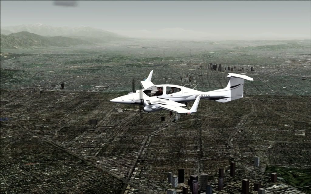
Los Angeles in the distance
Approaching Van Nuys and KVNY, home of Santini Air in Airwolf
Van Nuys is a district in the San Fernando Valley region of the City of Los Angeles, California, United States.
Lot sales began at the new town of Van Nuys on February 22, 1911. The area is named after Isaac Van Nuys, who was of Dutch descent and participant in a ranching enterprise called the San Fernando Homestead Association, a group that purchased most of the southern San Fernando Valley (south of present-day Roscoe Blvd) in 1869 to grow grain and run sheep. Van Nuys split this huge acreage, with his senior partner, Issac Lankershim, getting the east area (present-day Lankershim Blvd. crossed his section). Van Nuys also built the first wood frame house in the San Fernando Valley in 1872.
But in an odd sense, it was never Isaac Van Nuys' town--land speculators simply borrowed the name of his holding, the Van Nuys Ranch. The City of Los Angeles, and William Mulholland were building the Owens River aqueduct, starting in 1905 and to be finished in 1913. The San Fernando Valley was where the water was headed--first--and speculators were out to buy the Van Nuys Ranch--and subdivide it into 3 cities, Van Nuys, Marian (now Reseda), and Owensmouth (now Canoga Park) and start land sales just as the aqueduct was finished. Issac Van Nuys took his money--left his name on the town--and returned to his Los Angeles elite--with an office building remaining downtown with his name.
The speculators, organized into the Los Angeles Suburban Home Association, including Harry Chandler and Harrison Gray Otis of the Los Angeles Times, Moses Sherman, a streetcar line owner, and Hobart Johnstone Whitley, a real estate promoter with ties as far back as the "Land Run of l889" (the Great Oklahoma Land Rush), bought Van Nuys out, and prepared to sell the San Fernando Valley.
From the grand opening and barbecue, Washington's Birthday, 1911, Van Nuys was sold as "The Town That Started Right", plotted with set-asides for a high school and commitments to build important buildings "first", including the Bank of Van Nuys, changed but still standing on the southwest corner of Van Nuys Blvd and Sylvan Street, to give a sense that the vacant lots sold, with little more than stakes and ribbons flapping in the breeze, would bloom into a city. A major artery--double wide street--with a Pacific Electric "Red Car" line between the traffic--was built all the way from Hollywood, over Cahuenga Pass, through Lankershim (now North Hollywood) out Chandler Bl, turning right into Van Nuys on Van Nuys Bl, and then turning to the west on Sherman Way to extend to the other "new cities" on the Van Nuys Ranch, Marian (now Reseda) and Owensmouth (now Canoga Park). Big selling points in l9ll--H.J. Whitley's idea--built by partner and builder Moses Sherman,take the Pacific Electric interurban--and be downtown in an hour--or drive the paved road alongside--("no speed limit"--if your Model A could do 35 mph)--all season.
And the unlimited Owens River aqueduct water--oranges, orchards,sugar beets, speciality crops--all available when the young Van Nuys voted to join the greater City of Los Angeles in l9l5.
But the so-called "The Town That Started Right" was built on Tyrone Wash--two blocks east of Van Nuys Blvd--and would flood at the drop of a hat.
Two pioneers to be noted--Hobart Johnstone Whitley, promoter extraordinare, one of the "Boomers" who built towns in a day after the l889 "Oklahoma Land Rush", who drew the designs for some 150 towns with a stick in the dust, including the San Fernando Valley cities of Van Nuys, Reseda and Canoga Park, and founder of Hollywood, just over the hill. Whitley also had a huge home along his ceremonial boulevard, the "first house" you saw as you turned from Chandler Blvd unto Van Nuys Bl.
Second, William P.Whitsett, who bought a half-interest in the Van Nuys townsite, and remained as real estate salesman and town booster, and whose influence grew till he was Chairman of the Metropolitan Water District, where he helped oversee the second great aqueduct that boosted Los Angeles' position, the Colorado River Aqueduct to Los Angeles in the 1930's.
Van Nuys developed slowly--currently remaining is a fine collection of 1920's and 1930's churches and California-style bungalows, which now make up a "historic preservation overlay zone" (2004) generally east of the 1914 Van Nuys High School. By the end of World War II, when the GI's were demobilized, and many came West, Van Nuys and the San Fernando Valley lived through a tremendous boom.
Many call the San Fernando Valley (and Van Nuys) in this period "America's Suburb", as in the Kevin Roderick book. Dr. Seuss even opined on what made the typical Van Nuys resident in a bit of poetry parodying "The Organization Man" of the 1950's.
If you "cross" all your "T's" and "dot" all your "I's"--
You can get a job in "IT" (information technology)
And you can live in Van Nuys..."
In that same sense, the Van Nuys of the 1990's has suffered the criticism of another humorist, Sandra Tsing Loh, in her book, "A Year In Van Nuys".
Van Nuys is in the heart of the San Fernando Valley and home to about 100,000 people; the main thoroughfare, Van Nuys Boulevard, is noted for its car dealerships, its "Auto Row". It also functions similar to a "county seat" for the Valley, with its Government Center (Erwin Street Mall) containing a branch of the Los Angeles County Superior Court, Van Nuys police station, the Van Nuys offices for Los Angeles City Hall, Van Nuys State Office Building and a branch of the Los Angeles Public Library.
The 1945 General Motors Van Nuys Assembly Plant, a major manufacturing facility for General Motors' Chevrolet division along with aerospace and defense plants in neighboring cities led to a prosperity which inspired many to call the San Fernando Valley "America's suburb" (as in Kevin Roderick's book). Neighboring Panorama City sprang up--a thousand tract homes and 1950's mall, all on the promise of GM's new factory. But General Motors left, aerospace declined, and when the GM plant was dismantled in 1998, all that remains is a "big box store mall" called The Plant.
Like many central San Fernando Valley neighborhoods, Van Nuys was a middle-class neighborhood as late as the 1970s, but the demographics of some neighborhoods in Van Nuys have changed considerably since then.
In late 2004, the San Fernando Valley's first historic preservation overlay district was established in an area of early 20th Century bungalows east of Van Nuys High (founded 1914). According to the November 23, 2004, Los Angeles Times, "The neighborhood has become a melting pot of ethnic groups and home styles. Nearby stand such historic buildings as Van Nuys High School (1914), the Spanish colonial "old Van Nuys library (1927), the WPA-funded Van Nuys City Hall (a miniature 1/3 size copy of the downtown City Hall) and the 12th Church of Christ Scientist (1932)."
More in Reply -=-=-=-=-=-=-=-=-=-=-=-=-=-=-=-=-=-=-=-=-=-=-=
Looking back towards Burbank, California
Burbank is a city in Los Angeles County, California. The estimated population in 2007 was 107,921.
Burbank is located in two distinct areas, with its downtown, civic center and key neighborhoods nestled on the slopes and foothills that rise to the Verdugo Mountains, and other areas located in flatlands at the eastern end of the San Fernando Valley, 12 miles (19 km) north of Downtown Los Angeles.
Billed as the "Media Capital of the World,"[1] many media and entertainment companies are headquartered or have significant production facilities in Burbank, including Warner Bros. Entertainment, Warner Music Group, NBC Universal,The Walt Disney Company, Cartoon Network, Viacom, and PBS.
At one time it was referred to as "Beautiful Downtown Burbank" on Laugh-In and The Tonight Show Starring Johnny Carson.
The city was named after David Burbank, a New Hampshire-born dentist and entrepreneur.[
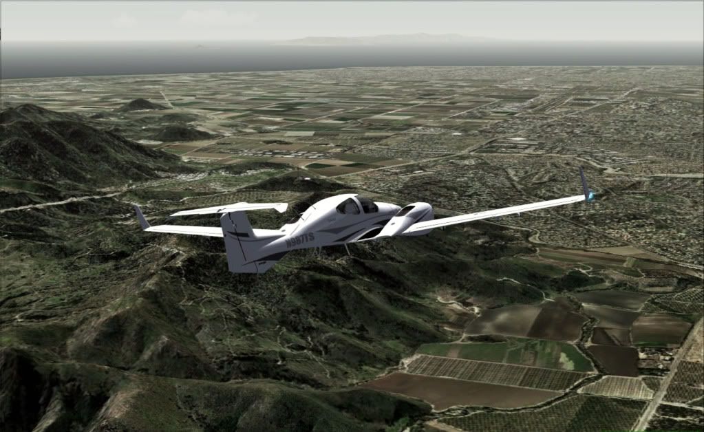
Heading towards Camarillo with Oat Mountain in the distance
Oat Mountain is a peak of the Santa Susana Mountains overlooking San Fernando Valley (near Los Angeles, California) to the south and southeast. Oat Mountain is the highest peak in the Santa Susana Mountains of California. The Los Angeles district of Chatsworth is to the south of the mountain.
Flying over Canoga Park looking towards Agoura Hills and Calabasas. The San Diego Freeway runs through the center of town.
Agoura Hills is a city in Los Angeles County, California, and has the ZIP code 91301. The population was 20,537 at the 2000 census. It is is located in the eastern Conejo Valley between the Simi Hills and the Santa Monica Mountains. This city on the Ventura Freeway (U.S. Route 101) straddles the border between the county of Los Angeles to the east, west and south and Ventura County to the north. It is approximately 30 miles northwest of Downtown Los Angeles and less than 10 miles west of the Los Angeles City limits (Woodland Hills). Agoura Hills and unincorporated Agoura are also situated next to Calabasas, Malibu, Oak Park, and Westlake Village.
The area was first settled by the Chumash Native Americans around 10,000 years before present. As the Alta California (Upper California) coast was settled by Spanish Franciscan missionaries in the late 1700s, the El Camino Real (the Royal Road or King's Highway), a road from Loreto, Baja California, Mexico to Sonoma, California, and connecting the Spanish missions in California, was established through the heart of what would later be known as Agoura Hills.
In about 1800, Miguel Ortega was granted a Spanish grazing concession called Rancho Las Virgenes or El Rancho de Nuestra Se�ora La Reina de Las Virgenes. The grant was abandoned after Ortega's death in 1810, and Jos� Maria Dominguez was given Rancho Las Virgenes as a Mexican land grant in 1834. Maria Antonia Machado de Reyes purchased the rancho from Dominguez in 1845. The "Reyes Adobe" ranch headquarters can still be found today in a museum along Reyes Adobe Rd. in central Agoura Hills. The historic Reyes Adobe Museum, owned by the Los Angeles County Parks and Recreation Department, was built in the mid-2000s around the site of the old adobe.
By 1900, Agoura Hills was being used as a popular stage stop for travelers along the Camino Real because of its natural spring at the foothills of Ladyface Mountain, one of Agoura Hills' defining geographic features.
In the 1920s, the community was briefly known as Picture City, as Paramount Pictures owned a ranch in the area used for filming Westerns. To obtain a post office of its own the residents were required to choose a one word name, and in 1927 chose a misspelling of the last name of Pierre Agoure, a local Basque man and French immigrant who had settled in the area in 1871 to live the lifestyle of the Mexican rancher and styled himself Don Pierre Agoure, accordingly. Agoure was a successful sheep herder and had a reputation as a swashbuckler. His name was chosen for the post office as it was the shortest name proposed.
Rapid growth occurred in the Agoura Hills area starting in the late 1960s, in the wake of the construction of the Ventura Freeway section of U.S. Route 101 through the city's heart, an action that isolated the northern half of the city from the south. The first housing tracts started in Agoura were Hillrise, Liberty Canyon and Lake Lindero. Growth continued at a rapid pace during the 1970s. Schools were built and much of downtown was erected.
In 1978, residents of the Agoura Hills area banded together to lobby Sacramento to widen the Kanan Bridge. Legislation was introduced and passed requiring the State Department of Transportation to award contracts for widening of the Kanan Road bridge overpass, over the Ventura Freeway, from two lanes to four lanes.
In 1982, the residents of the City of Agoura Hills voted in favor of cityhood by a 68% majority. Agoura Hills became the 83rd City in Los Angeles County. Elected to the first City Council were Mayor Fran Pavley, Mayor Pro Tem Carol Sahm, Councilmembers Ernest Dynda, John Hood and Vicky Leary. Incorporating a year after neighboring Westlake Village, the drive for cityhood in the region was largely based on public discontent with the county's failure to limit residential development of the area, motives that influenced Malibu and Calabasas to follow suit in 1991.
The 1980s was a period of tremendous growth, with large land areas being subdivided into housing tracts and a great wave of migration of people into the city. In the 1990s numerous businesses also set up shop in the city, and the downtown area was filled with shops and restaurants
In 1996, however, the murder of Jimmy Farris (the infamous Brandon Hein case) shook the city and awakened it to a rising drug problem and petty theft crime wave among its young. As a result, the city began sponsoring live music competitions and concerts in local parks.
Chatsworth Peak
Chatsworth Peak is a peak in the Simi Hills overlooking Chatsworth, California on the east. Is southwest of Santa Susana Pass and nort of the Chatsworth Reservoir at an elevation of 2,313 feet (705 m). Nearby are Simi Peak in western Simi Hills, and Oat Mountain in the Santa Susana Mountains.
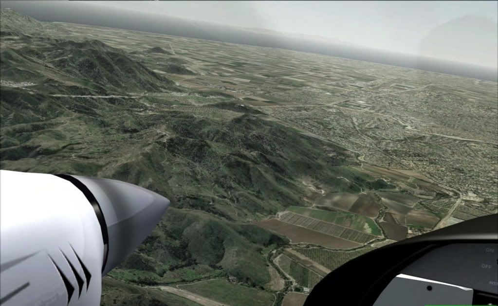
Flying along RT 101 near Camarillo, with Moore Park and Somis in the distance
Looking back towards the Agoura Hills, you can see the Pacific Ocean
From the Flight Deck�
Descending towards Camarillo, getting ready to do the pattern
Camarillo is a city in Ventura County, California, United States. The population was 57,077 at the 2000 census. A January 1, 2006, California Department of Finance estimate lists the population at 64,034. The Ventura Freeway (U.S. Route 101) is the city's primary thoroughfare.
Camarillo is named for Adolfo and Juan Camarillo, two of the few Californios (pre-1851 California natives of Spanish ancestry) to preserve the city's heritage after the arrival of Anglo settlers. As with most cities in Ventura County, it is noted for its resistance to urban sprawl. Some of the most desirable land in the city limits, located on the north and south sides of the Ventura Freeway, is "permanently" zoned for agricultural use. The construction in these zones show the progressive erosion of permanence. It is home to the Ventura County, California Sheriff's Department Academy, as well as the department's other assets; such as the VCSD Air Unit, SWAT Unit, Bomb Squad, and Reserve Officer Academy
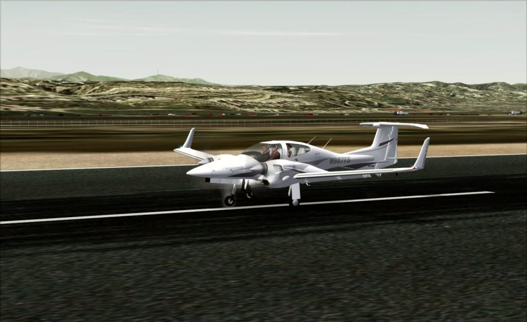
One nose that doesn't need a Job on it � look at that beauty!
The Chumash Indians were the first known settlers in what is now known as Ventura County. Fishermen built their villages along the Pacific Coast near the mouths of the Calleguas Creek and Santa Clara River. Artifacts from their settlements are on display in the Ventura County Historical Museum and their paintings are still visible on canyon walls and in caves in the area.
The Portuguese navigator Juan Cabrillo, while exploring the Pacific coast for the king of Spain, came upon the Chumash in an area near Point Mugu. He explored the surrounding region and claimed it in the name of Spain in 1542. Cabrillo was followed in 1602 by Sebastian Viscaino on a mapping expedition for the King of Spain. The Chumash continued to inhabit the coast until 1768 when Russians, having established a settlement 800 miles (1,300 km) to the north, launched expeditions challenging the Spanish land claims. In the 1700s the Spanish began settling California and built the first of what would become a chain of 21 missions in San Diego. Father Jun�pero Serra establish the ninth mission in Ventura in 1782 bringing more settlers to the area and exposing the Indians who had settled around the mission to many European diseases to which they had no immunity. Their numbers diminished until the Chumash, once the largest Indian nation in California, had largely vanished by 1839.
Making our Descent�
By the early 1820s, Mexico had gained independence from Spain and shortly afterward California allied itself with Mexico. The Mexican land grant system was liberalized in 1824 resulting in many large grants in California and the proliferation of Ranchos north of the border. One grant to Jos� Pedro Ruiz created Rancho Calleguas in 1837, in the area that is now Camarillo. The grant was later sold to Juan Camarillo, who had arrived in 1834 as a member of the Hijar-Padres Expedition; it was his sons Adolfo and Juan that are credited with the founding of the town that was to bear their name. The earlier proposed name of Calleguas was rejected as too difficult to pronounce.
Approach and Landing in reply =-=-=-=-=-=-=-=-=-=-=-=-=-=-=-=-=-


 Very nice work!


 I'm from RI, and we have a road in Massachusetts, RT 128 that is similar to that...break down lanes are even open for regular use!


